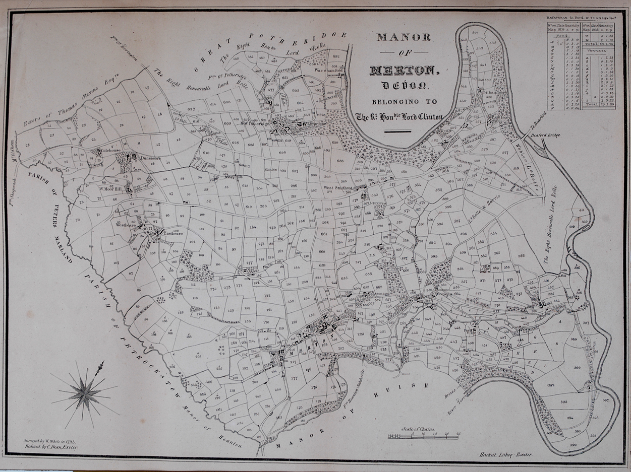
This Map is from an old reprint of a map of 1794 showing the extent of the Manor of Merton which then belonged to Lord Clinton. Many properties are no longer existing, some interesting facts are the left right importance of roads/tracks and 2 fords across the river, one below Pinkhill at Wareham Ford and one at the bottom far right hand side which is now part of Huish. Merton Mill Farm was called Venners, Moor Hill was West Moor Hill,, Westbeare was standing and the area around Towell was know as West Smithcot. Little Potheridge was named N.W. Potheridge. Further down the track past present day Little Potheridge farm house was Leverton's another property that has been demolished. Yeory area had 4 properties there, one named East Yeory and another Sitham Yeory. The ground belonging to Potheridge and so Specott is not recorded as this was in the ownership of others. Regreatbaly no key to the field names remains but you can see what a maze of small fields there were. several which appear to be remains of strip farming perhaps.